State of Casco Bay, Maine

REVIEW 1992 TO 2021

STATE OF THE BAY REPORTS

STATE OF CASCO BAY

6th Edition

Every five years, Casco Bay Estuary Partnership gathers and analyzes the best available data on water quality, land use, habitat coverage, and other key indicators to assess the Bay’s health. We present the findings in State of the Bay reports that share vital information used by stakeholders and decision-makers to protect and enhance the condition of the Bay.

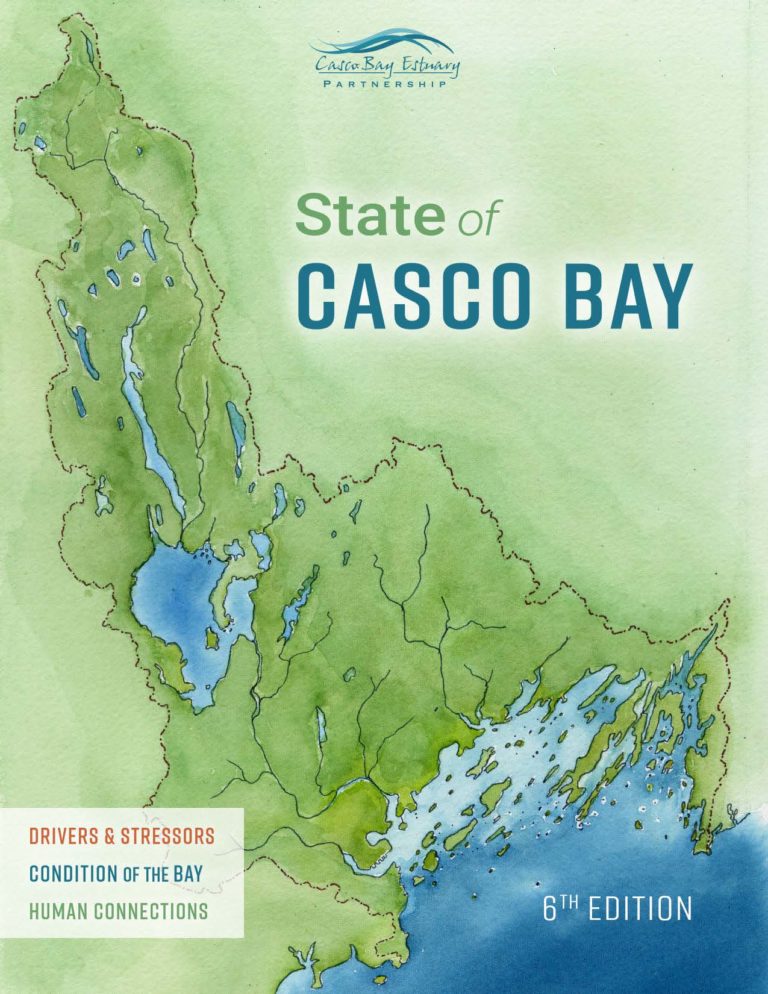
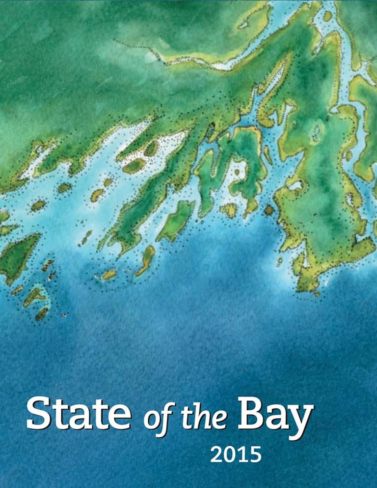
State of Casco Bay, 6th Edition marks nearly thirty years of science and monitoring efforts that have greatly improved understanding of the Bay and documented three decades of change. It presents findings for nineteen indicators organized in three groups: Drivers & Stressors, Condition of the Bay, and Human Connections. Together, these interrelated indicators provide a framework for understanding the causes and outcomes of change in the Bay and for implementing effective solutions.

The entire report may be viewed and downloaded as a printer-friendly PDF file. Individual chapters may be viewed online by clicking on chapter titles in the Table of Contents below. Buttons at the bottom of each chapter’s web page provide options to view/download a pdf of that chapter, see supplementary information, or go to the data repository.

The keynote speech presented by CBEP Director Curtis Bohlen at the November 2022 Maine Stormwater Conference is available here.

Introduction

DRIVERS & STRESSORS

What’s Affecting the Bay?

A. Population & Land Use

New Suburban Construction Eats into Forests and Agricultural Lands

Population of Casco Bay Watershed Grew Nearly 10 Percent in 18 Years

B. Stormwater

Stormwater Runoff Degrades Water Quality in Urban Streams

Salt from Winter Deicing Products Poses a Threat to Urban and Suburban Waters

C. Combined Sewer Overflows

Community Investments Have Reduced Pollution from Combined Sewer Overflows (CSOs)

Discharges from CSOs Dropped by Eighty Percent Over Two Decades

D. Inland Water Quality

Most Lakes and Streams Meet Water Quality Standards

Urban Waters More Likely to Have Poor Water Quality

E. Climate Change

Maine’s Climate Has Been Changing for Decades

Winters Have Become Warmer, and Rainfall More Intense, as Sea Level Has Risen and High Tide Flooding Increased

F. Invasive Species

Invasive Species Persist in a Warming Casco Bay

Tunicates Are Especially Abundant and May Displace Other Species

CONDITION OF THE BAY

How Is the Bay Doing?

G. Bay Water Quality

Bay Water Temperatures Increased 1.6°C (3°F) in Three Decades

Inshore Waters May Be More Vulnerable to Water Quality Problems

H. Nutrients

Nutrient Pollution Puts Bay Water Quality at Risk

Community Efforts to Protect Water Quality and the Bay’s Natural Resilience Have Prevented Widespread Impacts

I. Aquatic Connectivity

Sea-Run Fish Regaining Access to the Presumpscot Watershed

Relic Dams Block Fish from Swimming Up Royal River, Stroudwater River, and Some Coastal Streams

J. Eelgrass

Eelgrass Increased from 2013 to 2018 but Remains Below Historical Abundance

Beds in Freeport and Brunswick Rebounded Through Natural Propagation

K. Coastal Acidification

Coastal Acidification Varies Seasonally, Daily, and Among Locations in Casco Bay

Scientists Are Investigating Local Patterns and Causes of Acidification

L. Swimming Beaches & Shellfish Beds

Elevated Bacteria Levels Occur at Some Monitored Locations

High Bacteria Numbers More Common Downstream of Urban and Suburban Areas

M. Toxics

Persistent Toxics Have Declined Over Past 30 Years

Uncertainties Remain about Impact of Novel Contaminants

HUMAN CONNECTIONS

What’s Being Done?

N. Conserved Lands

Fourteen Percent of Land in Casco Bay’s Watershed Has Been Permanently Conserved

In Coastal Communities, Conservation Land Approaches Ten Percent

O. Coastal Habitats

Casco Bay Has 16,655 Acres of Tidal Habitats

Over a Hundred Acres of Tidal Marshes Restored Through Culvert Replacement

P. Economics

Bay Has $700 Million Economic Impact

Tourism and Marine Resources Are Key Sectors of Coastal Economy

Q. Education

Place-Based Education Engages Thousands of K-12 Students Around Casco Bay

Schools and Nonprofits Collaborate to Provide Environmental Education

R. Stewardship

Volunteers Donate More than 17,000 Hours to Stewardship of Casco Bay

Organizations Engage Volunteers in Wide Range of Roles

S. Climate Preparedness

Municipal and Community Leaders Take Action Toward Climate Resilience

Many Paths to Community Resilience and Adaptation in Casco Bay

Supplementary Materials

Data Repository

Selected data and data analysis code for certain Indicators are available for review at GitHub. A full archive of data and all analysis steps is available at GitHub Details.
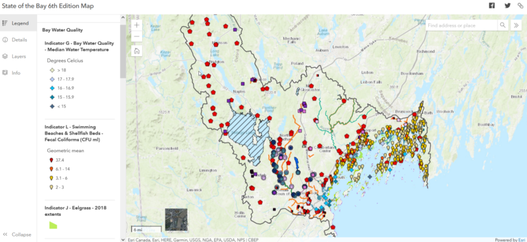
Interactive Map

Explore interactive versions of many of the maps featured in the State of Casco Bay, 6th Edition.

Regional Highlights

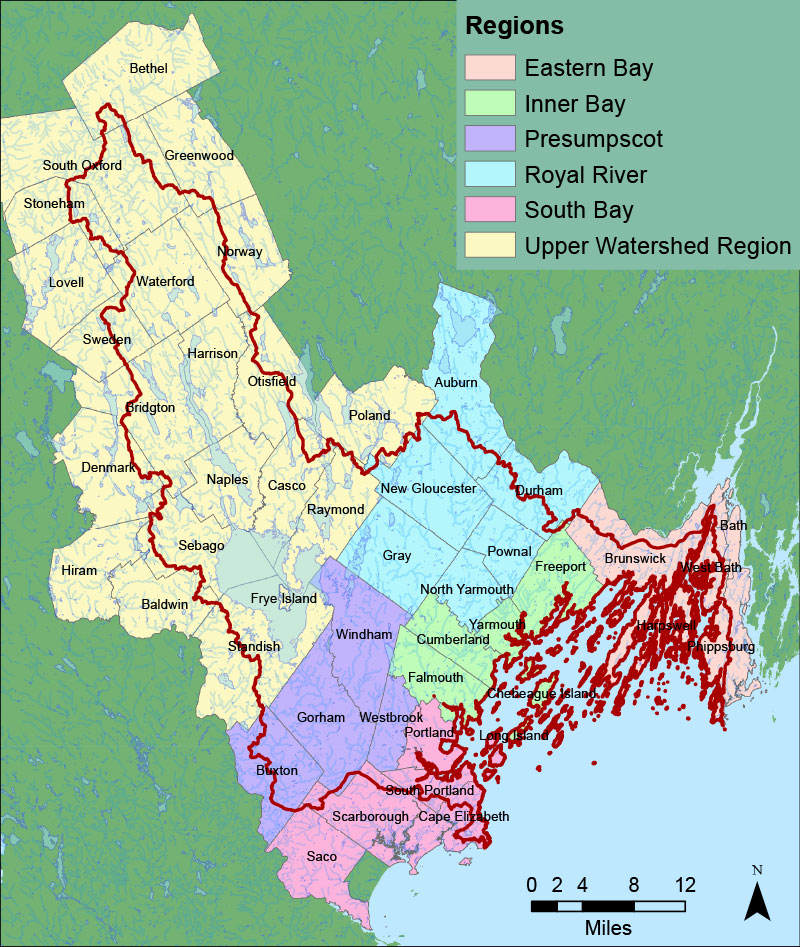
Towns in the Casco Bay watershed have been divided into six regions that cluster around major subwatersheds. For more information on each region, visit the Regions & Watersheds section of our website.

See highlights of State of Casco Bay findings pertaining to each region:

The Casco Bay watershed is divided into six regions: Eastern Bay, Inner Bay, Presumpscot, Royal River, South Bay, and Upper Watershed.

If you would like to receive a printed State of Casco Bay report, send an email request to cbep@maine.edu.

This document has been funded by the U.S. Environmental Protection Agency under Cooperative Agreements #CE00A00348-0 and #CE00A00662-0 with the University of Southern Maine.

Suggested citation: Casco Bay Estuary Partnership. State of Casco Bay, 6th Edition (2021).

Acknowledgments

REPORT ARCHIVES

2015 State of the Bay Report

2015

State of the Bay report

2015 State of the Bay Presentations

2015

State of the Bay Presentations

2010

State of the Bay report

2005

State of the Bay report

2000

State of the Bay report

1992

State of the Bay report